The Italian Land Registry system explained in brief
The Catasto
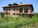
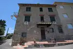
In Italy, the Catasto (Cadaster) is the land registry which contains graphical, census and administrative data on properties throughout most of the country1. The Catasto is divided into two parts: one covers urban properties, the other covers rural land. The Catasto is used primarily for tax purposes.
Over time most paper records have been converted to digital format and updates are now performed electronically. Historically, maintenance of Catasto records left a lot to be desired, a common problem elsewhere too. With the advent of digitization, various laws have been enacted with the goal of significantly improving both the quality and freshness of Catasto data.
The deeds, rights and liens registry
A separate deeds, rights and liens registry, the banca dati ipotecaria, contains information on property ownership, indicating who has or had legal rights to a property, including mortgage liens and other limitations on ownership. Somewhat confusingly this registry is often referred to by a series of alternative names:
- registri immobiliari – "property registries", derived from when separate manual registries were maintained across the country.
- conservatoria dei registri immobiliari – the former maintainer of the ownership records, part of the now defunct Agenzia del Territorio.
- pubblicità immobiliare – "property public notices" is the function of the database and is the terminology often used by the current records maintainer, the tax agency, Agenzia delle Entrate (Inland Revenue / IRS).
Note: although the word ipotecaria may bring to mind the word for mortgage lien, in this case its meaning is more expansive, covering the gamut of property rights and limitations. Many translate banca dati ipotecaria as a database of mortgages, a major, if understandable, error.
Tip: The Catasto records system contains property ownership information but it doesn't constitute proof of ownership (probatorio). Don't look in the wrong place!
Today both registries are maintained by the Agenzia delle Entrate, part of an ongoing effort to ensure better data integrity and quality. Towns and cities also have a role in maintaining the Catasto records. Since 1 July 2010 property owners must declare at closing/completion that the Catasto documents (including the floor plan or lot map) reflect the real current state of the property.
Tip: Buyers should consider requesting a sworn technical report confirming building permit and tax office compliance. This has become standard practice in Tuscany (except the province of Lucca) and in some of Emilia-Romagna.
As there are currently two separate property registries, buyers will need to request two separate records to verify both what they are buying and who has legal rights to it:
- The visura ipotecaria is the property ownership record for a property which includes liens and other limitations. It is important to obtain a record including the history for the past 20 years.
- You can try to do it yourself, or you can ask a better real estate agent or notaio to do it for you (fees will apply).
- The visura catastale refers to the land registry documentation which includes the administrative identifiers for a property, the appraised value for tax purposes (rendita catastale), the size and graphic representation of the property (floor plan or lot plan).
Owners can download, free of charge, visure for properties they have an interest in.
We offer an Italian property title search service for property you think you may own. Don't hesitate to contact us should you have questions about the sales process and/or wish us to assist you in purchasing property in Italy as your buyer's agent (property finder).
Footnotes
¹ This discussion excludes areas of Italy which were previously part of the Austrian-Hungarian empire, more or less the provinces of Trento, Bolzano, Trieste and Gorizia. In these provinces and some neighboring towns in the provinces of Udine, Brescia, Belluno and Vicenza the Catasto is a single database which also proves ownership.
❖ ❖ ❖
The above is offered as general guidance without warranty; changes may have occurred since it was written. Do consult with appropriate qualified professionals regarding your specific situation before making any real estate purchase.
About the author

Sean Michael Carlos grew up in Rhode Island, USA. He studied in the US, UK and Germany before settling in Italy where he has lived for over twenty-five years, in three different regions.
Sean is a licensed real estate agent in Italy with over 10 years experience in the sector and would love to hear from you if you are looking to buy or sell property in Italy.
 4
4